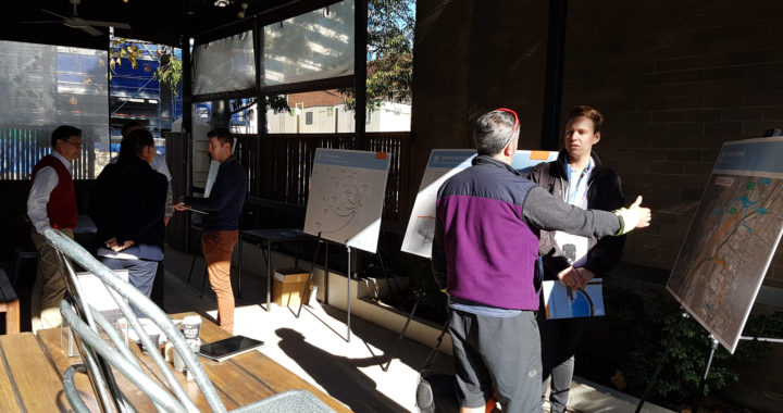
Following questions from the community about the Sydney Gateway Concept Design, we have created these Frequently Asked Questions (FAQ). Our outline of the concept design is here.
What is the difference with the Proposed Replacement Path vs Alternative Path?
These are the two options presented as part of the Concept Design.
BIKEast support the Proposed Replacement Path as it is the most direct for all path users.
How many paths are there in the concept design?
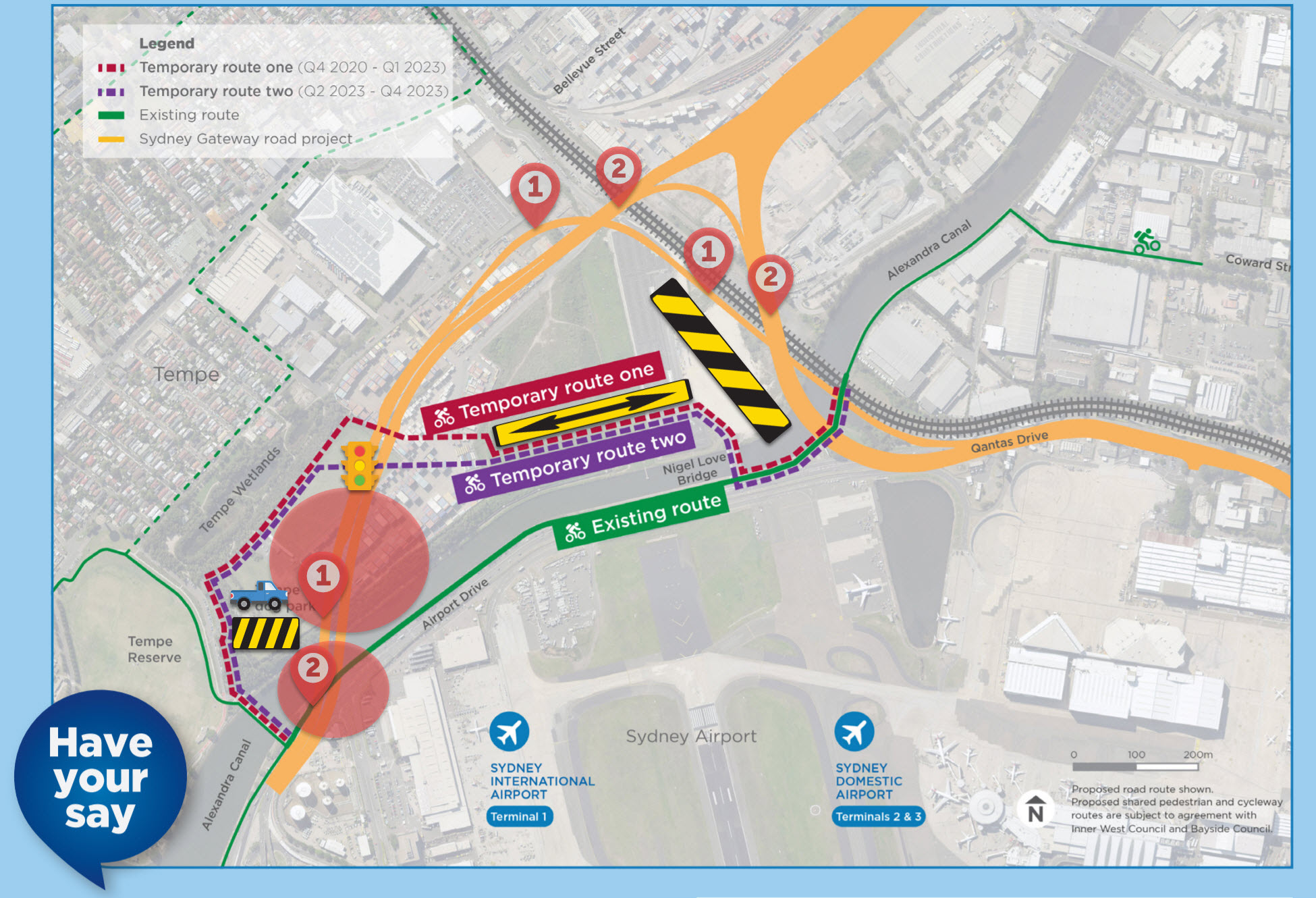
There are 2 types of routes:
1. During construction: Temporary routes (One and Two)
2. After construction – options: Proposed Replacement
1. During construction: Temporary routes (One and Two)
2. After construction – options: Proposed Replacement
Temporary Routes
Why can’t the Proposed Replacement Route be built straight away?
The first stage will require setting up the foundational structure for the Airport Drive bypass (marked as #1 on the above image). Once this is done, Airport Drive can be closed. This will require a large area close to the water / ground level – and take up significant space along the northern side of the canal.
Why are there two temporary routes?
The first stage is implementing the Airport Drive bypass (marked with #1s) which includes a signalised intersection to facilitate travel via the Link Road for freight into the airport (see the overview diagrams).
These signals will facilitate and allow people walking and cycling to cross the traffic along this new roadway, hence the alignment for Temporary Route Two to use this signalised location. (see traffic light signal).
The routes sound like they transition from RL3 (start of temporary route) to RL15 (approximate first intersection of temporary route with road), we are investigating what this means for elevation.
Why is the alignment of the temporary routes so odd?
The main worksite will be to the right of the image. (See yellow/black box on image). The supplementary worksite (parking, storage) will be on the left.
As the runway lights require alignment and width in this space, there is a straight passage planned to allow construction to move between the two worksites. (see yellow double sided arrow on image)
The decision has been made to run the walking / cycling detour along this convenient passage.
Replacement Routes

Does the purple Alternate Route run alongside the Rail corridor?
No, it was planned to run along the motorway.
The eastern end of the route is actually a switchback to connect back to the existing stretch of Alexandra Canal cycleway and towards Coward Street.
Will the blue Proposed Replacement Route underpass have flooding issues?
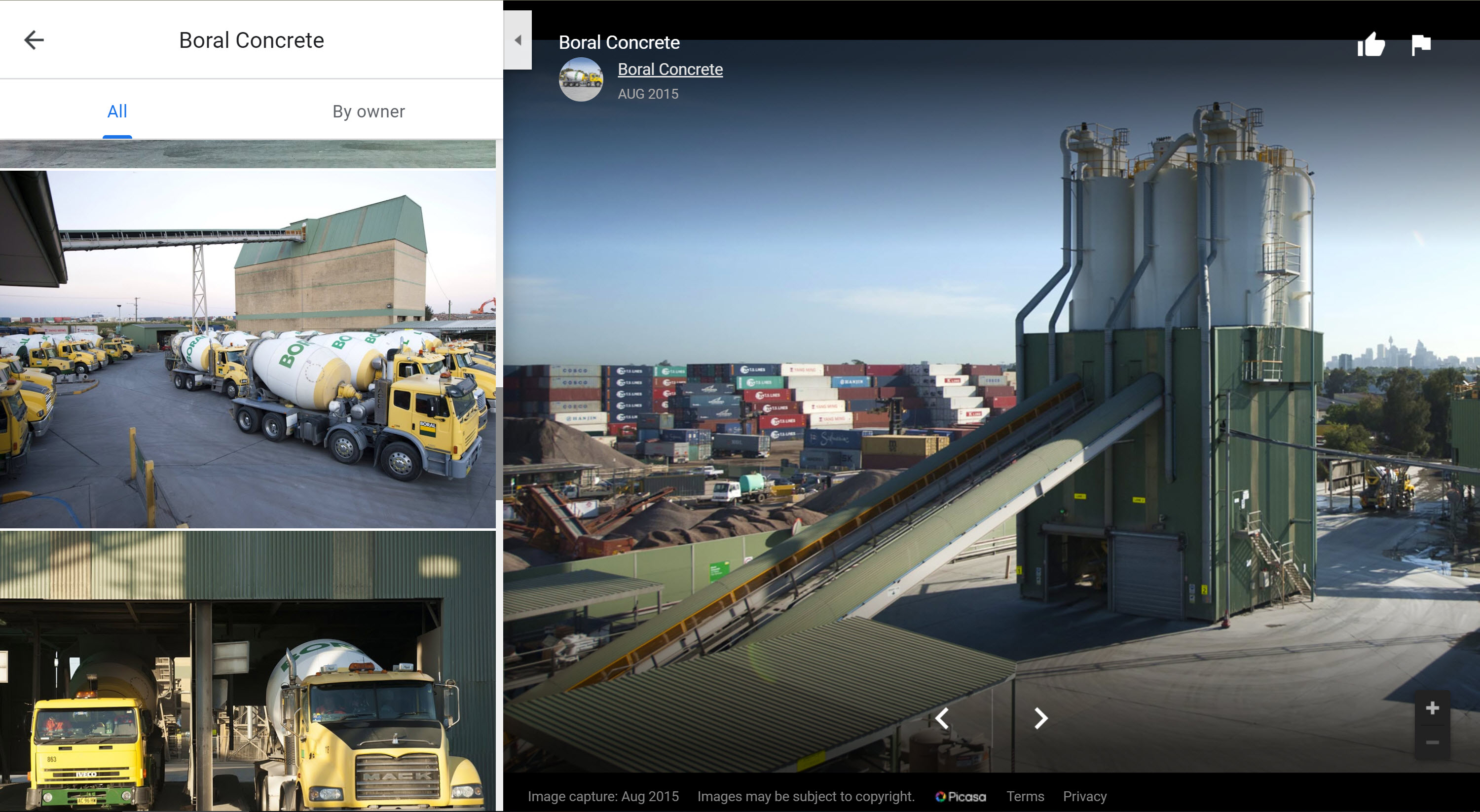
Note that the two motorway arms (orange lines marked with #3s on diagram) will be quite high – 5.5m above rail bridge, halfway up the Boral buildings (pictured below and marked as orange witches hat on diagram).
The Proposed Replacement route (blue on diagram) will be the same height as the existing rail bridge.
The Proposed Replacement route (blue on diagram) will be hung off the road bridge (orange on diagram), rather than using columns in the water (which will also minimise side effects to flooding issues), before connecting to the existing rail underpass.
What about a tunnel?
There are twin constraints of a high water table and height restrictions due to air space requirements. These make it difficult to raise the roadway further or provide a tunnel for the cycleway.
Has there been discussion of how this project will connect cycling and walking to the surrounding areas – St Peters Interchange and domestic terminal?
There has been some discussion, but no traction and is not under the responsibility of this project.
BIKEast will continue to push for a safe connected cycling and walking network in this area.