6 June 2019 – This page was updated to clarify that the Alternative route was an option, rather than a planned route (in addition to the Proposed Replacement route). We have created a Frequently Asked Questions page here.
Priorities
Ahead of the new Sydney Gateway motorway project, the surrounding cycling and walking advocacy groups have joined together on a Change.org petition and agreed on 3 important asks for people cycling in the community:
- A cycling and walking route along Alexandra Canal from Tempe Reserve to Coward St (equivalent to the existing facility, if not improved) during and after construction.
- A cycling and walking route linking the Alexandra Canal pathway with the Sydney Airport Domestic Terminal and Bayside Council’s proposed Eastern cycling network (Wentworth Ave, Mill Pond greenway, Foreshore Drive).
- A bicycle route linking the Alexandra Canal pathway to Sydenham Station and to Sydney Park.
Concept Design out now
The concept design portal has been published and is open for community consultation until 21 June 2019.
We encourage you to have your say.
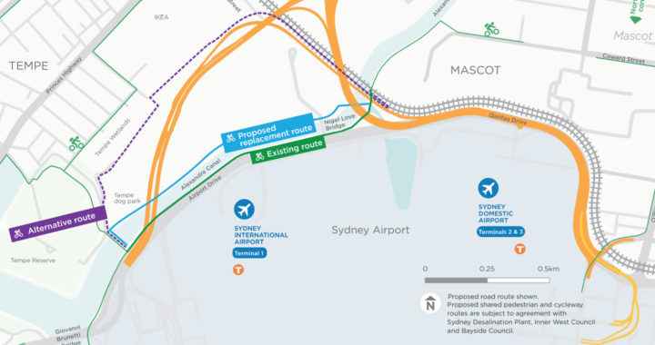
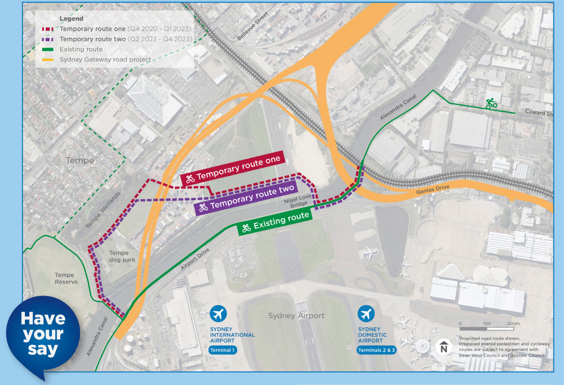
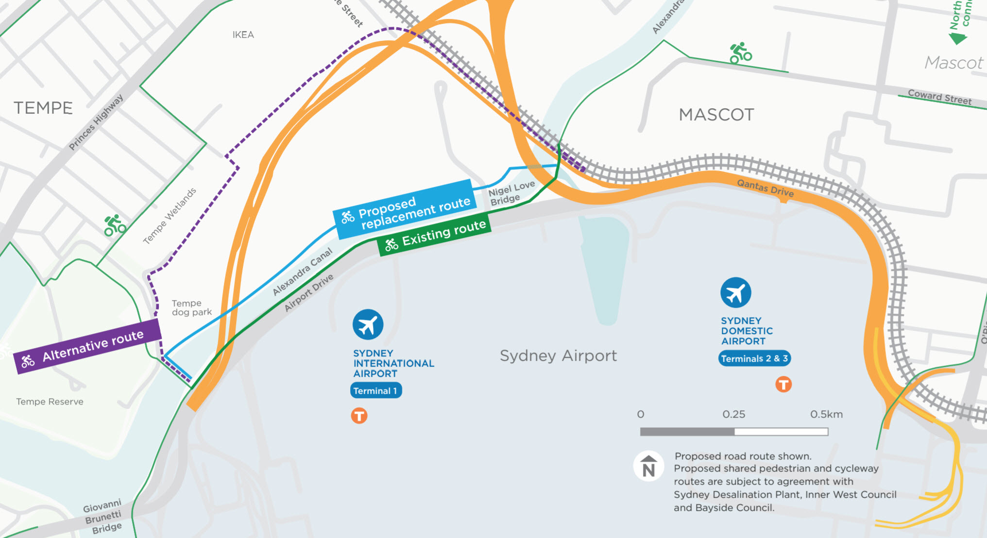
There are a few routes of interest for people walking and cycling.
- During construction: Temporary routes (One and Two)
- After construction options: Proposed Replacement route (direct) vs Alternative route (parkside)
During Construction
Both temporary routes during construction use existing structures to cross Alexandra Canal.
After Construction
The Proposed Replacement route (blue line) crosses at existing bridge and a new underpass. This is the preferred route by local groups.
The project has also provided an Alternative (parkside) route (purple line) that goes through the parklands before following the motorway back, with a switchback to connect back to the existing canal cycleway and Coward St.
Current Community Concerns
See the answers in our FAQ page.
Temporary routes – Elevation – The two temporary paths offered put people up and over the highest part of the container yard.
Temporary routes – General safety and amenity –
– sufficient signage, maps and wayfinding during and after construction
– adequate lighting to ensure as much passive surveillance as possible during and after construction
– management of path surfaces during construction to ensure safety
– adequate lighting to ensure as much passive surveillance as possible during and after construction
– management of path surfaces during construction to ensure safety
Replacement route – Flooding – There are also concerns regarding whether the underpass below the Nigel Love Bridge will be flood proof.
We remember how flooded the underpass near Tempe station used to get. The flooding has been improved, however the underpass is quite short in height.
There has also been statements by local council that flooding is the reason an underpass to cross Princes Highway along the nearby Cooks River at Tempe is not possible.
Alternative route – fast track? – As the alternative route looks to be in space currently unoccupied, can the alternative route be built now, rather than waiting until the full project is finished?
Replacement route – Petition Asks 2 and 3
– Future commitment for future active travel connection to surrounding areas
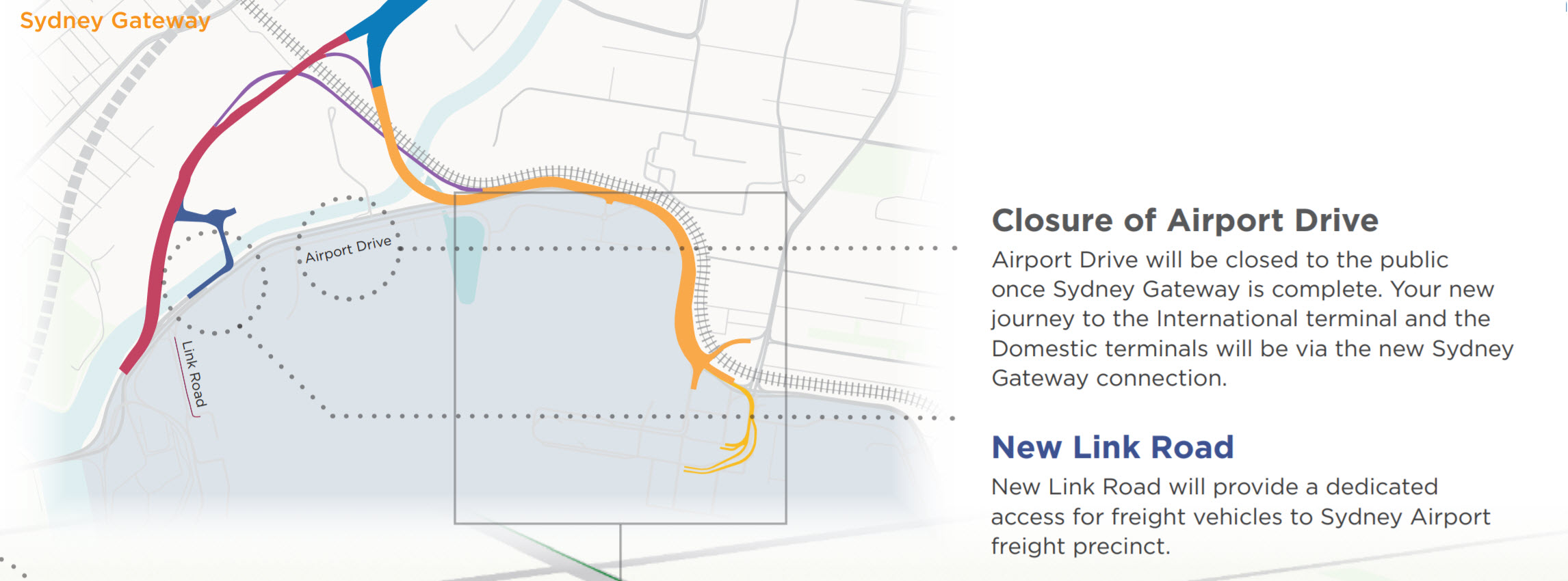
– Especially for airport staff moving between terminals. If Airport Drive is closed to the public, will the replacement route include walking and cycling connections to Qantas Drive / T2/3?
– Future commitment for future active travel connection to surrounding areas
– Especially for airport staff moving between terminals. If Airport Drive is closed to the public, will the replacement route include walking and cycling connections to Qantas Drive / T2/3?
Any other concerns? Contact us on Facebook.
You can also visit the Sydney Gateway team in person to discuss:
Information sessions:
Thursday 6 June, 8:00 a.m. – 11:00 a.m. – Patchett’s Pies, Mascot
Thursday 13 June, 4:00 p.m. – 7:30 p.m. – Rowers on Cook, Wolli Creek
Thursday 6 June, 8:00 a.m. – 11:00 a.m. – Patchett’s Pies, Mascot
Thursday 13 June, 4:00 p.m. – 7:30 p.m. – Rowers on Cook, Wolli Creek
Information booths:
Wednesday 5 June, 10:00 a.m. – 1:30 p.m. – Mascot Woolworths
Saturday 8 June, 9:00 a.m. – 12:00 p.m. – Wolli Creek housing complex
Wednesday 5 June, 10:00 a.m. – 1:30 p.m. – Mascot Woolworths
Saturday 8 June, 9:00 a.m. – 12:00 p.m. – Wolli Creek housing complex
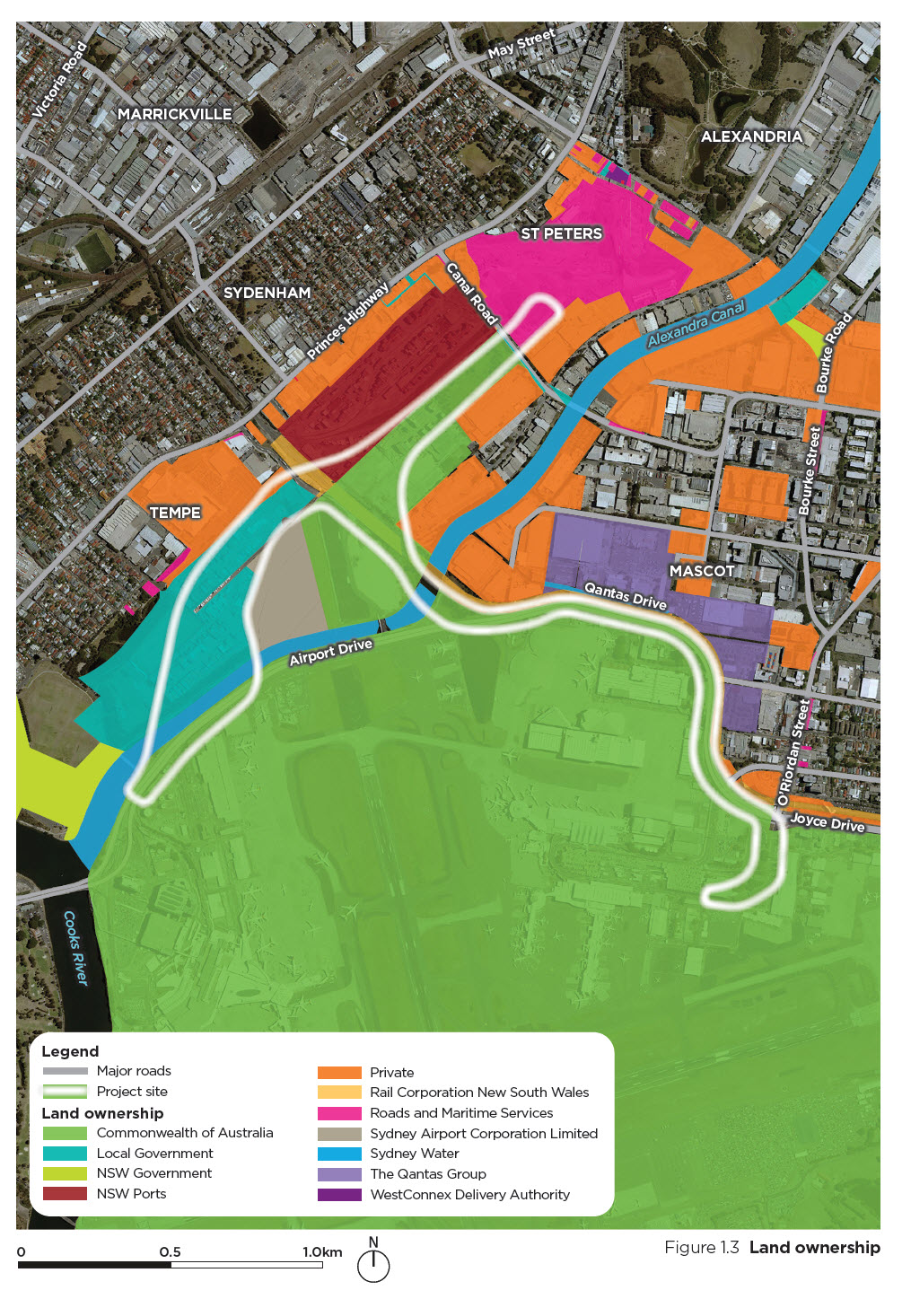
Sydney Gateway – land ownership diagram