Westconnex – New M5, opening in 2020, will provide underground motorway tunnels, stretching from Kingsgrove to the new St Peters Interchange (SPI) spaghetti junction.
St Peter’s Interchange Active Travel Network (Page 35 – Planning Condition B50)
This is covered in two main documents:
- Planning Condition B50 – Pedestrian & Cycling Network Review
- Planning Condition B51 – Pedestrian & Cycling Implementation Strategy
The documents are quite lengthy, so we have written up a summary of the proposed routes and connections below. Click on each image to view in detail.
Planning Condition B50 – Network Review (PCNR)
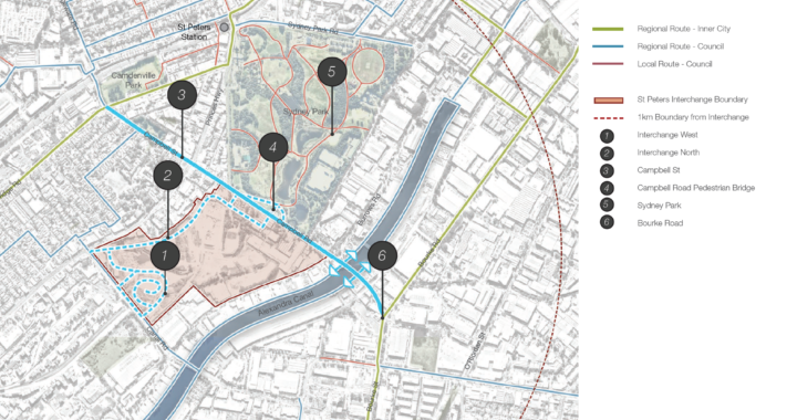
This report outlines the investigation of active transport at the St Peters Intersection (SPI) as well as a review of the M5 Linear Park and the M5 East Green Link ATN route from Kingsgrove to St Peters.
5.1 – Campbell Road between May Street & Bourke
Road
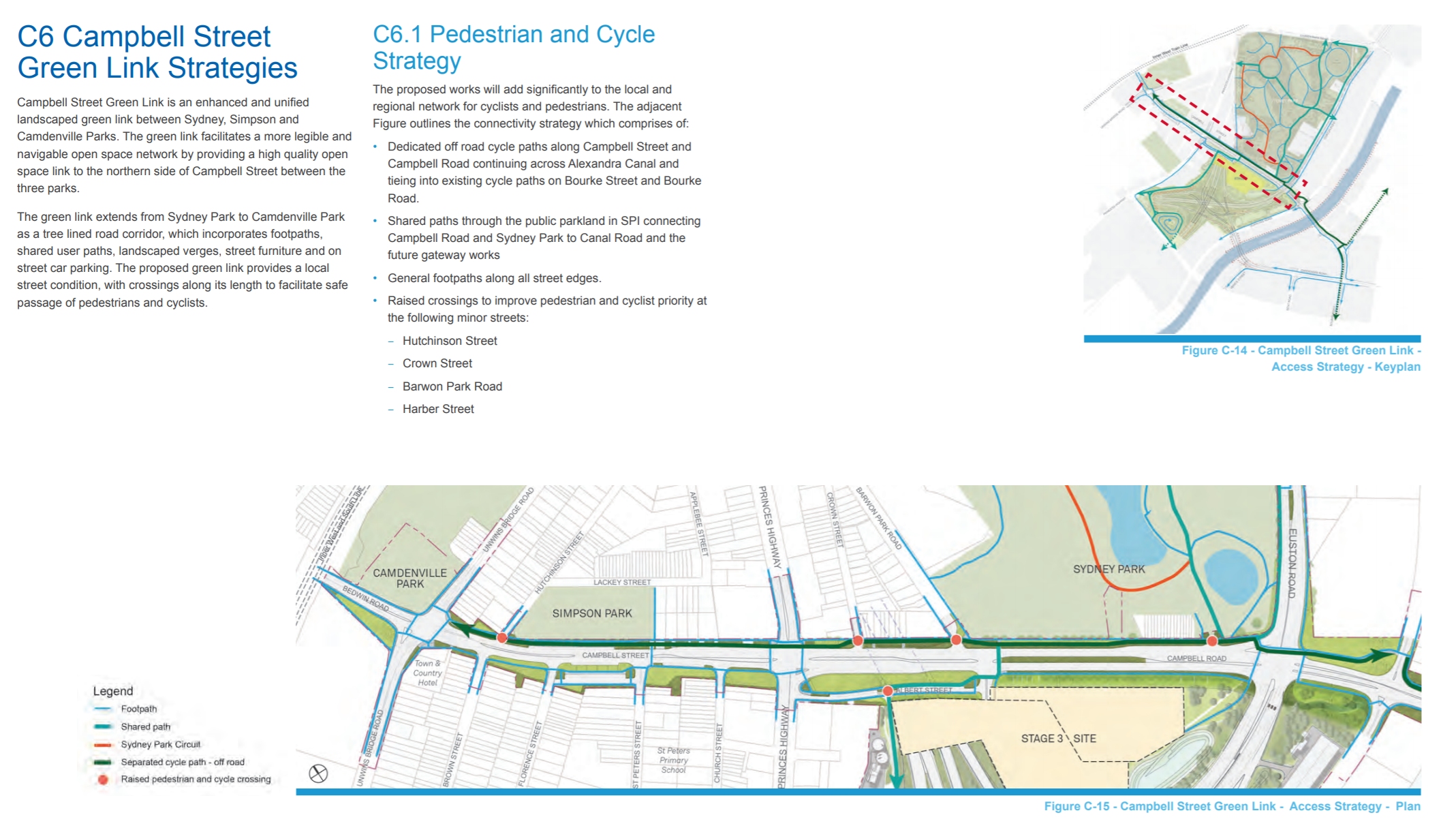
- A mixture of cycle paths and shared paths. Separated cycleway along the Northern side.
- Raised crossings to improve pedestrian and cyclist priority at minor streets.
(See Page 15 – Appendix C – Campbell Street Green Link Sub-Plan)
Cyclists have the opportunity to use a shared path on the northern side of the new Campbell Road Bridge.
(See Page 23 – New M5 – B50 Pedestrian and Cyclist Network Review)
5.2 – Euston Road and Sydney Park Road intersection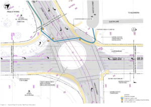
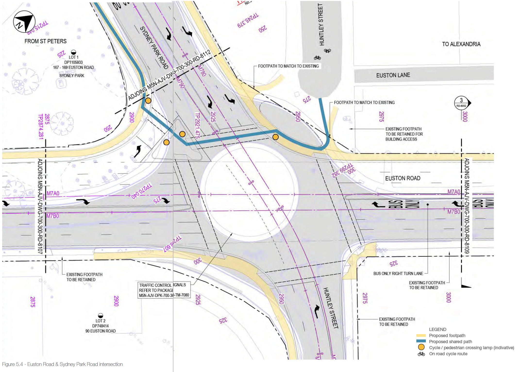
- Shared path across the intersection
- Cycle lanterns and wider crossings
(See Page 30 – New M5 Westconnex – B51 Pedestrian & Cycle Implementation Strategy.)
5.3 – St Peters Interchange cycle path

- Proposed shared bridge across Campbell Rd.
- Shared path through the St Peters Interchange, separated where width of open area allows.
- Access connection to the Bishop St carpark to provide an alternative entry/exit point at the midpoint of the path.
(See Page 32 – New M5 Westconnex – B51 Pedestrian & Cycle Implementation Strategy.)
5.4 – M5 East Linear Park shared path
Not in BIKEast Eastern Suburbs area.
5.5 – St Peters Interchange (SPI) Recreation Area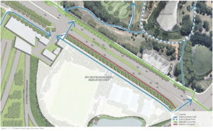
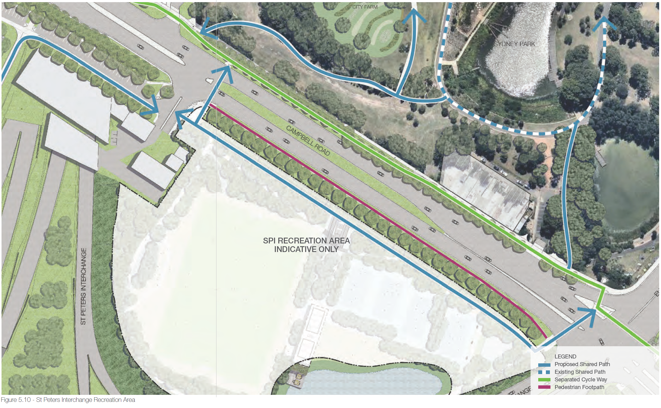
- Shared path through the SPI Recreation area.
- Two signalised intersections to enable crossing of Campbell Rd (corner of Campbell Road and Barwon Park Road and corner of Campbell Road and Euston Road).
(See Page 36 – New M5 Westconnex – B51 Pedestrian & Cycle Implementation Strategy.)
Planning Condition B51 – (Improvements) Implementation Strategy
This B51 report details the implementation strategy for the delivery of projects identified in the related Planning Condition B50 Pedestrian and Cycleway Network Review (PCNR).
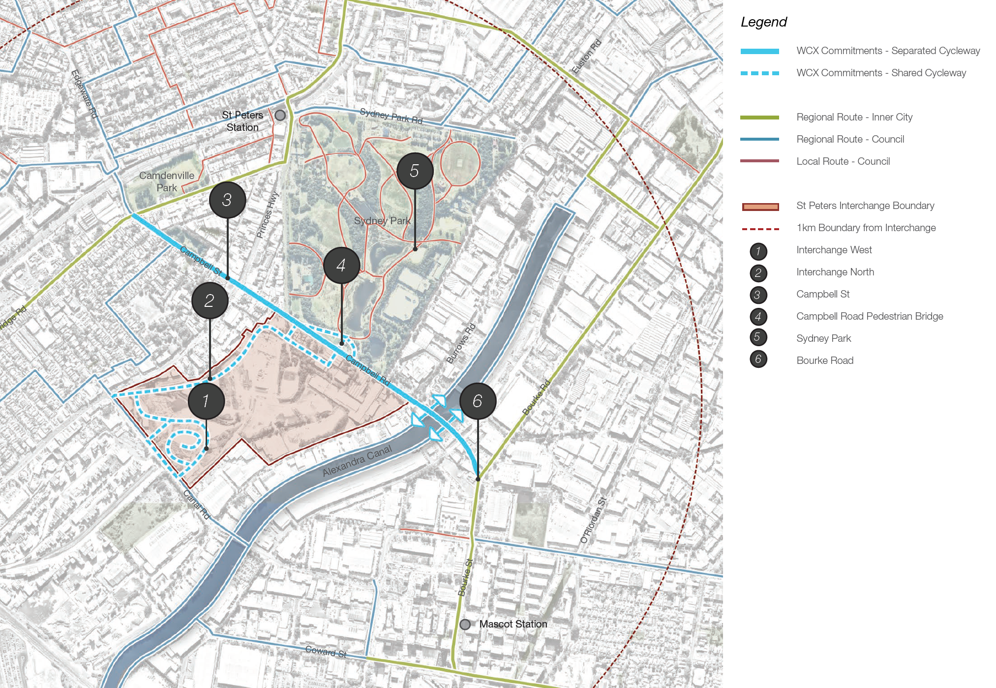
5.6 – Sydney Park – Alexandria – Moore Park
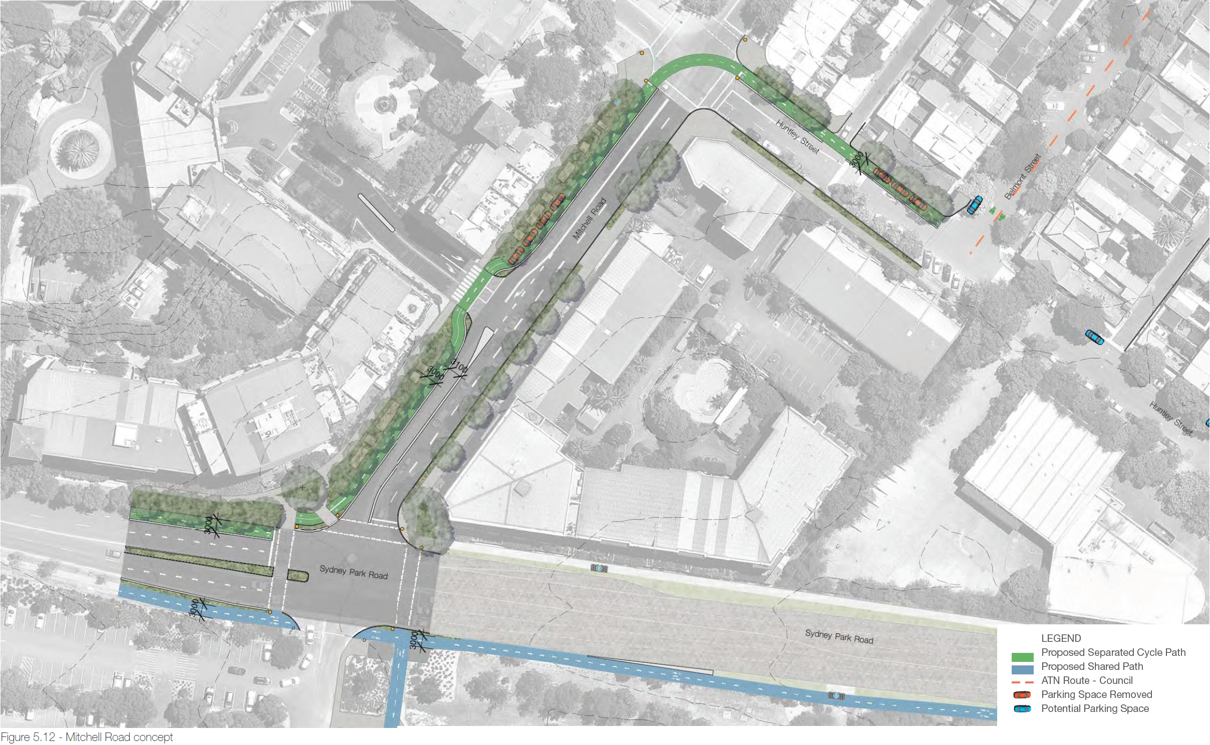
- Cycleway alongside Mitchell Rd to connect into Huntley St.
- The route connects back into Sydney Park which has an existing shared path.
- The Belmont Street on road bike path will connect through to the future shared paths along the north side of Euston Road and McEvoy Street associated with the Alexandria to Moore Park Connectivity Upgrade Project, which is currently in planning phase.
(See Page 38 – New M5 Westconnex – B51 Pedestrian & Cycle Implementation Strategy.)
5.7 – Campbell Street and Bedwin Road connections
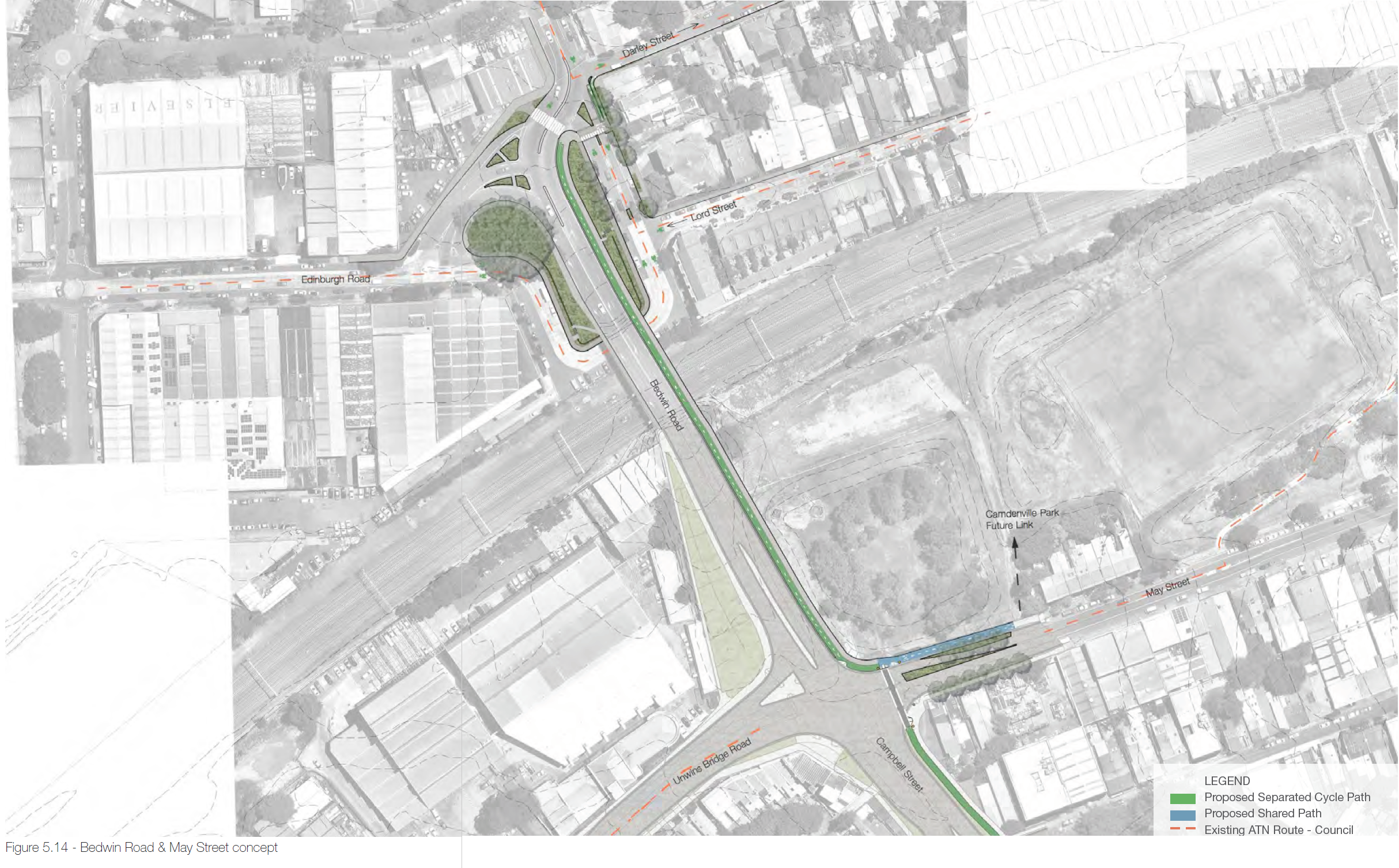
- An extended shared path from Campbell Street, across May Street into a shared path bordering Camdenville Oval
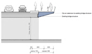
- A new clip-on shared bridge adjacent to the existing railway bridge.
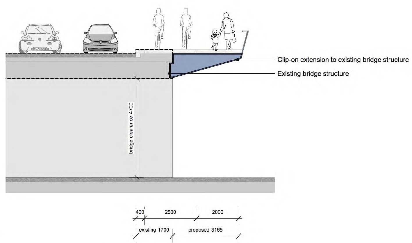
(See Page 40 – New M5 Westconnex – B51 Pedestrian & Cycle Implementation Strategy.)
5.8 – Princes Highway and Canal Road intersection

- Shared path connecting SPI area and existing on-road bicycle facilities including a connection into Mary Street’s contraflow bike facility.
- Plans to connect to Unwins Bridge Road (an identified inner Sydney regional bike route).
(See Page 42 – New M5 Westconnex – B51 Pedestrian & Cycle Implementation Strategy.)
5.11 – Sydenham Station Connection
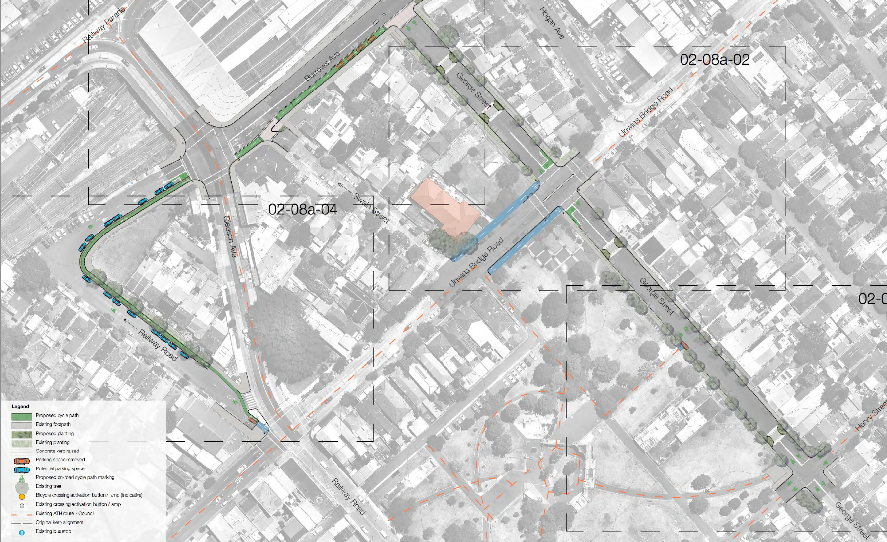
- A mixture of on-road and off-road cycleway routes to connect Sydenham station from Unwins Bridge Rd / George St.
(See Page 48 – New M5 Westconnex – B51 Pedestrian & Cycle Implementation Strategy.)
5.12 – Canal Road Shared Path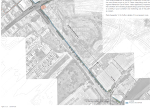

- A shared path along the north of Canal Road from the interchange to Burrows Ave
- A new cycle crossing signal at the existing signalised intersection at Burrows Road and Canal Road
- Provide a future shared path connection from along Canal Road south of Burrows Road to the future Alexandra Canal shared path, This link is subject to the completion of the Alexandra Canal shared path as this link would currently not provide any connectivity at present
(See Page 48 – New M5 Westconnex – B51 Pedestrian & Cycle Implementation Strategy.)
Future RMS Projects
5.9 – King Street Gateway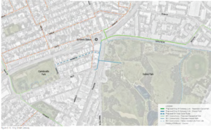

- Improved pedestrian and cyclist access to Sydney Park.
- New mid-block crossings on Princes Highway and Sydney Park Road aligned to pedestrian and cyclist desire lines.
- M5 B51 Connections include
- Shared path along Princes Highway (Sydney Park side)
- King St Gateway include
- Shared Path along Princes Highway (St Peters station side)
- Separated cycle path along Sydney Park Rd (Newtown side)
5.10 – Airport Gateway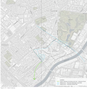
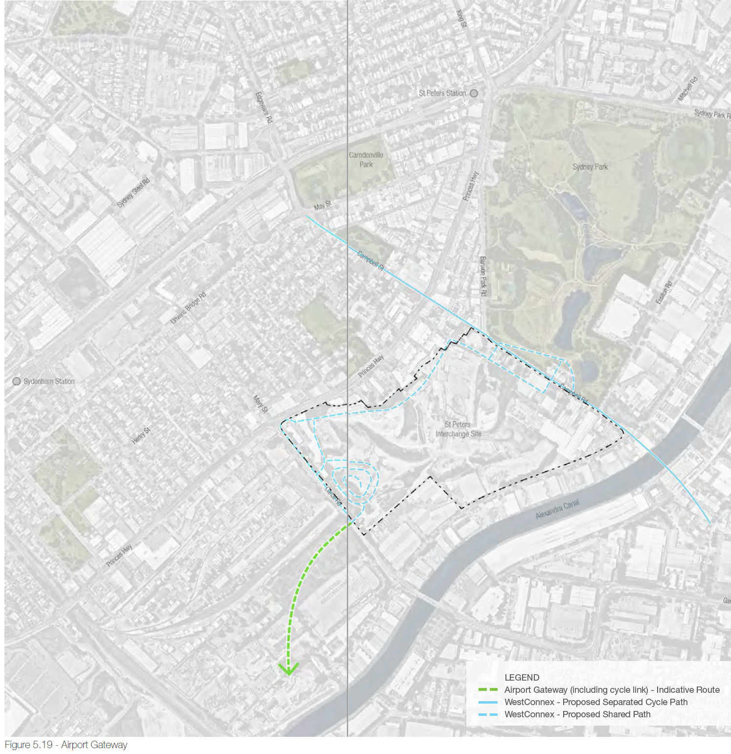
This will link the SPI with the ATN in and around the:
- Sydney Airport
- Alexandra Canal cycle path (both sides of the canal)
- Existing shared path along the southern side of the Alexandra Canal between Coward Street and the International Terminal
- A safe and connected cycle link across the Cooks River on or adjacent to the Giovanni Brunetti Bridge
As part of the SPI design, there is allowance for future pedestrian / cycle links associated with the Airport Gateway Project which will improve access for pedestrians and cyclists between SPI area and the airport. Figure 5.19 indicates the direction that the Airport Gateway may take. Attached: New M5 Westconnex – B51 excerpt – Airport Gateway Connection
Other Useful Information
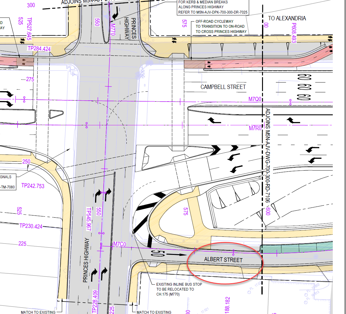
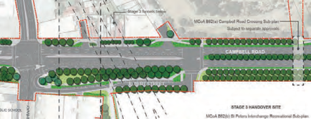
Where is Albert St?
Albert St is a new street that will run alongside Campbell Street: