BIKEast is pleased to make a submission on the Sydney Gateway Concept Design.
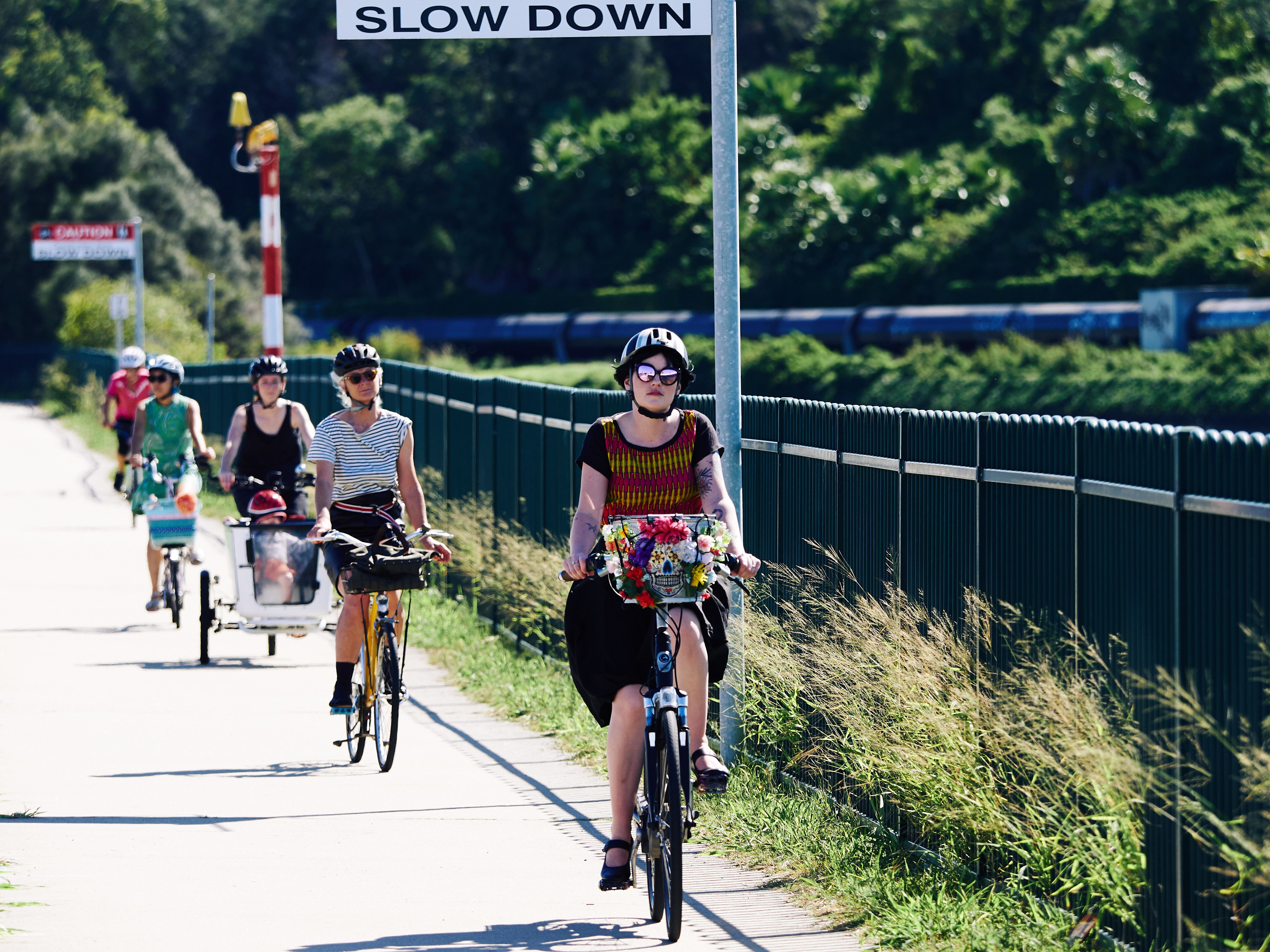
We believe that providing safe, continuous, and connected bike routes will encourage more people to ride their bikes more often – an outcome that is consistent with NSW and Local Government strategies to realise the considerable individual and public benefits of increasing the mode share of active travel (walking or cycling).
As such, BIKEast submits the following comments on the design elements.
Summary of issues
- We are pleased to see that the proposed replacement route provided is the most direct alternative to the connection being removed.
- We are grateful for the outline of the proposed temporary routes during construction, and emphasise that these routes must be safe and maintained during construction.
- The provision for adding active travel connectivity to Sydney’s network as outlined in NSW and Local Government strategy is significantly lacking from this concept design.
- Together with the local councils (City of Sydney, Bayside Council, Inner West Council) and Bicycle NSW, we have outlined 4 specific missing links in the active travel network that relate to the Sydney Gateway project space.
- We urge the Sydney Gateway project to work closely with these groups to improve and facilitate future connectivity of Sydney’s active travel network.
Direct replacement route for existing cycleway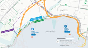

It is unfortunate that the existing cycleway facility must be removed, however, we thank the Sydney Gateway project for listening to the early feedback from stakeholders such as local councils and Bicycle NSW, and providing a replacement that is as direct as possible, alongside the canal. This will support and facilitate easy travel for people currently regularly using the existing route.
We understand that the connection around the rail bridge near Coward St is quite low and will require management for flooding issues, including a pump. We urge that this facility be designed well to include adequate maintenance and ensure safe community access all year round, including when the canal water level is high.
We understand the Alternative route marked on the map is not being proposed, as it was a previous proposal, however, we have identified this connection as a missing active travel network connection – that we have outlined in more detail later.
Outline of temporary routes during construction
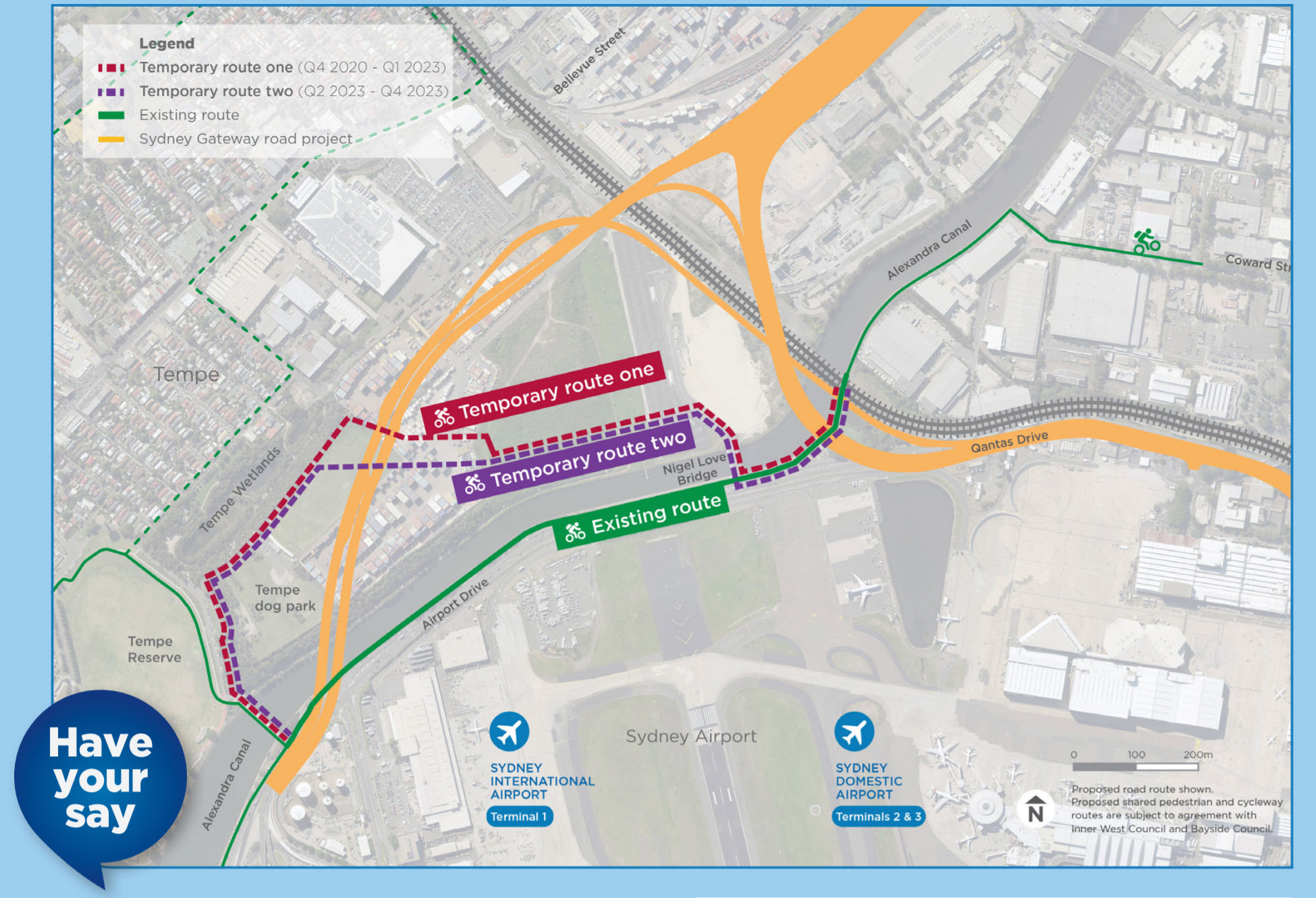
We thank the Sydney Gateway project for listening to our concerns and the concerns of our community and have committed to temporary active travel connections during construction as part of the construction planning. We understand that the routes are not confirmed and will need to be negotiated with Inner West Council.
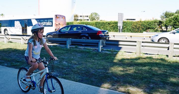
We urge the Sydney Gateway to ensure these safe connections are developed and maintained during construction.
Safety factors to be managed include minimal gradient changes, smooth and good quality surfacing, adequate lighting, minimal path obstructions and flooding provision.
BIKEast and Bicycle NSW are currently working with Austroads to incorporate better traffic management planning guidelines to support safety for vulnerable road users (people walking and cycling), during Australia’s current and future levels of construction and encourage Sydney Gateway to keep up to date and adopt best practice.
Missing active transport in the concept design
Sydney Gateway

The Sydney Gateway project outlines its benefits are to make journeys easier, faster, safer, but it lacks provision for a section of the community – people cycling and walking.
Westconnex New M5

The active travel connections outlined in the Westconnex New M5 – B51 – Pedestrian & Cycle Implementation Strategy are currently lacking, and the concept design does not provide any additional or alternative connections to the Westconnex New M5 infrastructure and surrounding destinations.
“The Airport Gateway will include ATN along the future Airport Gateway link.
This will link the SPI with the ATN in and around the:
- Sydney Airport
- Alexandra Canal cycle path (both sides of the canal)
- Existing shared path along the southern side of the Alexandra Canal between Coward Street and the International Terminal
- A safe and connected cycle link across the Cooks River on or adjacent to the Giovanni Brunetti Bridge
As part of the SPI design, there is allowance for future pedestrian / cycle links associated with the Airport Gateway Project which will improve access for pedestrians and cyclists between SPI area and the airport. Figure 5.19 indicates the direction that the Airport Gateway may take.”
Future Transport 2056
The Future Transport 2056 strategy states the benefits of sustainable transport – “Moving people from private vehicles to more sustainable transport modes will reduce congestion and the transport sector’s emissions intensity, improve air quality and support better health and wellbeing.
Well planned centres and cities, will enable a shift from private cars to public transport and active transport modes such as walking and cycling. In Sydney, the key to this will be the delivery of three 30 minute cities, supported by reliable ‘turn up and go’ mass transit services.” Future Transport 2056 – A Vision for Transport
The strategy also explicitly outlines Sydney Airport as a key location in the Eastern Harbour City as part of the “Metropolis of Three Cities, where people can access the majority of jobs and services within 30 minutes”, and states “Encouraging cycling could help relieve congestion and could more than double the number of people who can reach our three cities within 30 minutes.”
The Greater Sydney Principal Bicycle Network clearly states bicycle connections between Sydney Airport, Sydenham (Metro coming soon) and Wolli Creek.
Alexandra Canal masterplan
The 2001 Alexandra Canal masterplan (endorsed by surrounding councils) proposes “to create public access links along the tributaries and through large development sites adjoining the canal”. Alexandra Canal masterplan 2001 (Page 13-5)
As a result of this, a 10m setback has been written into each of the Development Control Plans (DCPs) of the areas surrounding the Canal. Diagram from City of Sydney DCP.
It is important that the space around Alexandra Canal is maintained as open community space, suitable for active travel.
Sydney Green Grid
Alexandra Canal has been identified as a Green Grid Project opportunity in the Central District, as part of the Hydrological Grid. “These list of projects were derived from the original Green Grid Reports together with the outcome from Greater Sydney Commission’s District Plan Workshops and NSW Department of Planning and Environment Open Space Workshops.” Sydney Green Grid – Spatial Framework and Project Opportunities – Central District (Page 126)
The Hydrological Grid commits to “Connecting public open space and active transport and pathway systems along waterways”. Sydney Green Grid – Spatial Framework and Project Opportunities – Central District (Page 9)
It is important that the space around Alexandra Canal is maintained as open community space, suitable for active travel.
Greater Sydney Commission
Under Planning Priority E6 – Creating and renewing great places and local centres, and respecting the District’s heritage:
Liveability – “Leading a healthy and active life means substituting walking and cycling for short car journeys. More people can be encouraged to walk and cycle where there is a safe road environment and suitable pathways. This requires better connectivity – direct routes to local destinations and services are required along streets that allocate sufficient road space to safe walking and cycling. A permeable and well-connected urban form that has human scale and attractive streetscapes is required.” Greater Sydney Commission – Eastern City District Plan (Page 48)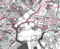
Productivity – “Where possible, the proactive and early reservation of corridors to protect longer term linear infrastructure opportunities should be undertaken to provide greater clarity and certainty for landowners, communities and businesses.
In assessing potential infrastructure corridors, economic, social and environmental outcomes need to be considered. The early preservation of corridors also reduces the potential for conflict in the future.
“Cycling improvements underway or being planned within, and to, the District are:
- Inner Sydney Regional Bicycle Network (see diagram)
- Inner West links
- Sydney Airport links” Greater Sydney Commission – Eastern City District Plan (Page 74-75)
The Sydney Gateway concept design not only removes existing connectivity used by people walking and cycling around Sydney Airport, but also removes the future potential active travel corridor along Qantas Drive to connect to T2/T3.
Sydney Airport Masterplan
Sydney Airport Masterplan states “Nearly 31,000 jobs are located at the airport itself, with many of these undertaken by people living in surrounding areas.” Sydney Airport Masterplan (Page 14)
“Staff movements at the airport are considerable and the number of people who travel to Sydney Airport for work on a typical working day has increased by about 20 percent since 2012.” Sydney Airport Masterplan (Page 138)
Future Transport 2056 states “The 30 minute city will be one where people can conveniently access jobs and services within 30 minutes by public or active transport, 7 days a week.”
The concept design does not currently improve support for local workers, in particular those at Sydney Airport, by providing safe and convenient active transport facilities.
Sydney’s Cycling Future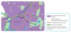
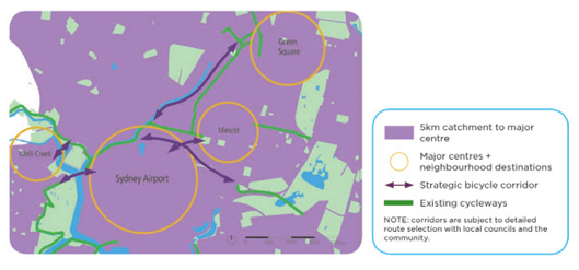
Sydney’s Cycling Future (2013) outlines how the State Government will improve the bike route network and make sure that the needs of bike riders are built into the planning of new transport and infrastructure projects. In Sydney’s Cycling Future, connections to Sydney Airport are mentioned in specific relation to support the workers at Sydney Airport. Also mentioned specifically are connections to the residential and commercial growth areas at Wolli Creek, Mascot and Green Square.
Specific Missing Links
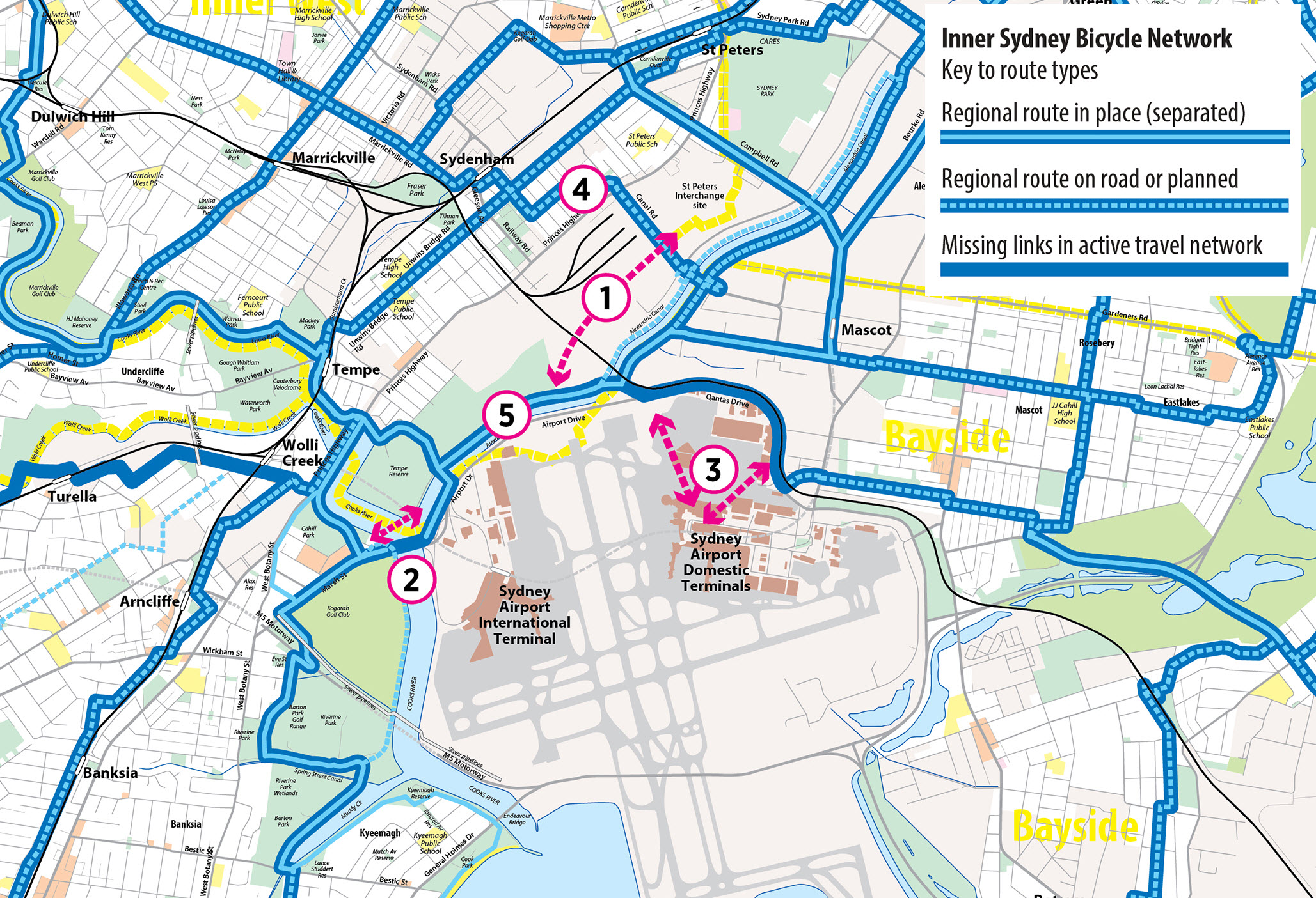
Missing Link #1 – St Peters Interchange to Alexandra Canal cycleway
As outlined in Westconnex New M5 Planning conditions, the intention of the Sydney Gateway project was to include connection from St Peters Interchange to Sydney Airport and the existing and future Alexandra Canal cycleway. This is currently missing from the design.
There are no current commitments to connect the East end of Canal Rd to Ricketty St (Westconnex is only building the West side), which means a missing East/West connection from Canal Rd to Coward St, Mascot.
Missing Link #2 – Direct crossing of Cooks River between South and CBD
With the replacement route alongside the West side of the canal, it is important to connect to the existing routes at Marsh St (RMS Airport West Precinct project). This link is missing due to the lack of a safe and suitable active travel facility across the Cooks River.
We understand that the existing Giovanni Brunetti/Marsh St bridge cannot provide this connection, as the bridge condition prevents any addition of a “clip-on” walking and cycling deck extension.
Options may include reallocating a road lane along this bridge for walking and cycling, or the provision of a new bridge spanning the river between the Tempe Reserve and the existing Marsh St AT infrastructure.
Missing Link #3 – Direct connections from Alexandra Canal cycleway to T2/T3 and beyond to Bayside Council Network
With the widening of Qantas Drive as part of this project, the future potential of a walking / cycling corridor between T1 and T2/T3 as outlined in the Inner Sydney Bicycle Network is no longer possible.
The existing poor quality path is currently being used by workers and commuters to access the Sydney Airport terminals. This link, inadequate as it is, will be removed by the current Airport Gateway proposals and no alternative put in place.
There should be additional options for connectivity here to enable accessibility and active travel to all the airport terminals from the surrounding suburbs.
Missing Link #4 – Direct connection between Coward St and Sydenham station (future Metro)
There is an opportunity for an East/West link through the Sydney Gateway space. This would provide a direct connection between the surrounding areas to Sydenham station.
The Eastern Suburbs has a lack of access to train stations and active travel is a perfect way to provide this connection at a relatively low cost. Activating connection to Sydenham station will be beneficial to the local community, as it is the closest Metro station to the Bayside Council area and the Southern part of the Eastern Suburbs.
Conclusion
The concept design is currently lacking in focus and commitment regarding detailed strategies for encouraging active travel. This is particularly disappointing given the benefits that improved facilities for active travel might bring to local workers/visitors, residents of adjoining areas and people using the roads bounding this space to get around every day.
BIKEast encourage the Sydney Gateway project to look at improving the active travel network, to better connect our local area, and encourage residents and visitors to partake in active travel.
We’ve identified major missing active travel links in the project:
- A connection from St Peters Interchange to the Alexandra Canal cycleway
- A direct, crossing of the Cooks River from the South towards the CBD
- Direct connections from the Alexandra Canal cycleway to T2, T3 and beyond, to the Bayside Council network
- A direct connection between Coward St and Sydenham station (and future Metro)
- We also urge that safe connections be developed and maintained during construction.
We believe the benefits of active travel to community and worker health, as well as traffic congestion, are important to the local community, and in particular Sydney Airport, and should be captured in the planning documents going forward.
Thank you for taking the time to read our feedback.